
Before
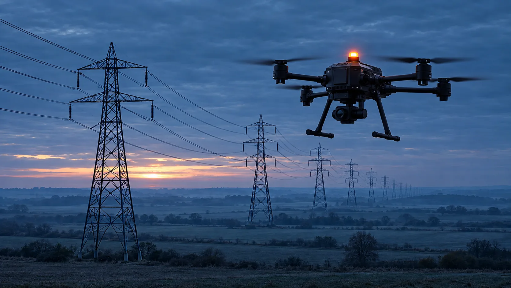
The route and the segments where coverage is expected to be weaker.
Infrastructure inspection
An inspection flight runs tens of kilometres beyond line of sight. Coverage changes with altitude and the operator needs to know where the image was reliable.
Needs: Two networks at onceEvidence after the flightControl from a centre
Illustrative case study
This is not a customer and not a flight that happened. It is a description of how this area would read if the image carried its age.
A high-voltage corridor, an illustration
The operator has a beyond-line-of-sight flight planned along a line. Coverage at altitude changes. A segment where the image froze must not look finished in the report.
In the example Platform splits the route into segments after the flight. Each has a frame age and time in Valid. A segment over the target is marked for another pass.
A second drone launches on the next segment while the first charges. The records are not mixed. The audit gets a pack, not a video without time.
The route and the segments where coverage is expected to be weaker.
Age and both networks are logged.
A segment over the target is not finished in the report.
AKIZU does not look for a damaged mast. It says whether the segment image is valid.
The chart requires JavaScript.
The chart is a simulation. Move the slowdown and see when the example stops being under the 50 ms target. The target is not a measured result.
Deployment schematic
The schematic is not to scale and is not a design for a specific site. It shows where the drone is, which two networks carry the frame and where the decision is made.
Red and blue beacons: police, state, the military in training. Orange: everyone else. The blink is only on screen. Schematic, design. The list beside it explains the codes in the drawing. The beacon is a payload from another maker, not an AKIZU product.
Concrete case
The same illustrative case as above, written out in time. The times are an example. It is not a record of a flight that happened.
An illustration, not a deployment record. N
Use options
Each row is a separate use. The Parts column says which AKIZU parts it would involve. Status N is a design, C is a target, U is unknown.
| Use | Who uses it | What AKIZU supplies | Parts | Status |
|---|---|---|---|---|
| A high-voltage line pass | Transmission operator | Age for each segment and time in Valid | Brain, SIM, Platform | N |
| Gas and oil pipelines | Pipeline operator | Segments that need another pass | Brain, SIM, Platform | N |
| A railway line | Rail infrastructure manager | An image with age at the tracks and crossings | Brain, SIM, Direct | N |
| Bridges and dams | Structure owner | A record of what was seen and when | Brain, Platform | N |
| An audit after a storm | Grid dispatch | A quick view of segments, not a video without time | Platform, Direct | C |
None of these uses is deployed today. A row is not an offer and not an authorisation to fly.
01
Operator coverage maps describe the ground. At flight altitude the drone may connect to more distant cells.
A SORA risk assessment needs a description of the control loop, including delay.
Without a frame-age record it is hard to find out why the operator reacted late on a segment.
Two drones shorten the day, but every segment needs its own pack. Otherwise a fault disappears between flights.
The same situation, different information on the screen. Proposed behaviour, to be verified in a pilot.
| Situation | Without AKIZU | With AKIZU |
|---|---|---|
| The image is late | The image looks live; the pilot does not know how old it is. | Frame age is on the screen and the state changes to Reduced freshness. N |
| One network fails | The image freezes or breaks up. | The frame arrives over the second network; the switch is logged. N |
| You need to explain what happened | Video without exposure time and without commands. | Evidence package with image age, states and commands. N |
| The pilot is in a centre far from the drone | Latency changes and the pilot cannot see it. | The deadline guard warns when a command arrives late. N |
02
The flow is illustrative. AKIZU is in development.
03
How many metres further the drone is than the image shows. Pick a scenario or set the speed and image age.
The interactive calculation requires JavaScript.
Scenario speeds are examples. 87.4 ms is the p99 measured internally over WiFi with a phone as transmitter, not on a drone.
04
| Requirement | How AKIZU answers it | Status |
|---|---|---|
| Coverage at flight altitude | Signal and network switches per segment in the evidence pack | N |
| Material for SORA | Frame age p99 and time in Valid for every flight | N |
| Long routes beyond line of sight | Two networks and the deadline guard in Direct | N |
| Verified number for the authority | AKIZU Verify optical measurement, planned Q4 2026 | P |
05
Sees on the route where the image stops being reliable.
Knows which segments to fly again.
Gets material for risk assessment and audit.
06
07
EASA introduced SORA 2.5 in September 2025 and several states no longer accept the older version.
Deutsche Telekom and Nokia demonstrated a drone whose network priority was temporarily raised at flight altitude.
Source: Nokia
Network latency is only part of the journey. Image age is the time from frame exposure on the drone to its display to the operator. VERA attaches the exposure time to every frame and the station verifies it before display.
The AKIZU design is built around LTE and 5G. According to the manufacturer, the Starling 2 Max base platform also supports Wi-Fi and Microhard. Our internal measurement was done over WiFi.
No. BVLOS flights need an authorisation in the Specific category based on a SORA 2.5 risk assessment. AKIZU Platform is meant to give the operator an image-age record as evidence for that assessment.
09
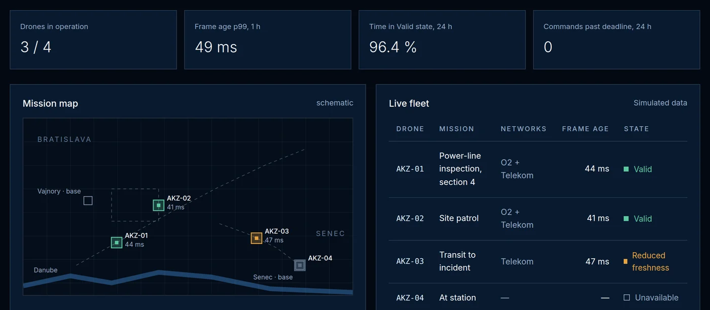
The three image states in this area. Proposed behaviour, to be verified in a pilot.
The segment can be used in the inspection report.
The segment is marked. The technician knows to fly it again.
The segment is not documented. It does not appear in the report as done.
10
Illustrative layout. Drone and station counts are an example, not an offer.
Line or track
Tens of kilometres beyond line of sight. Age per segment.
The next segment
A fleet shortens the day, but every segment has its own pack.
The operator's office
Sees which segments are reliable.
11
Times are an example. They show when image age decides.
12
AKIZU does not look for damaged masts. It says whether the segment image is valid.
It shows how the network behaved on this route, not the whole network.
It supplies numbers. The operator and the authority do the assessment.
A pilot in this area
We are looking for first partners. The application is pre-filled for this area.
Other areas
Example deployments are illustrative. AKIZU is in development and does not replace a BVLOS authorisation.
In more detail
A segment is finished only if its image met the target.
Bring the route and the segments where you expect coverage at altitude to be weaker. A report without that cannot mark a repeat pass.
We do not look for a damaged mast. We say whether the segment image is valid.
Explore
Twelve solution areas and the sections that belong with them. The case studies are illustrations, not completed deployments.