
Route
The altitudes are an example, not a standard.
Mobile operators
Operators want to offer connectivity for drones. Coverage maps, however, describe the ground. AKIZU shows how old the image is that your network carries at flight altitude.
Needs: Two networks at onceEvidence after the flightIntegration into your own drone
Illustrative case study
This is not a customer and not a flight that happened. It is a description of how this area would read if the image carried its age.
An aerial profile, an illustration
An operator wants to know how the network behaves at altitude, not on the ground. One good-looking flight is not enough for an aerial SIM offer.
In the example Brain Duo flies 30, 60 and 120 m. The report shows age, cells and the difference between days. An average that hides the difference does not belong in the report.
AKIZU does not switch on priority in the network. If the operator can switch it on, the comparison goes into the file. Availability of an aerial profile is still unknown.
The altitudes are an example, not a standard.
Another day, the same segment.
Numbers from the routes flown, not the whole network.
We are not a virtual operator.
The chart requires JavaScript.
The chart is a simulation. Move the slowdown and see when the example stops being under the 50 ms target. The target is not a measured result.
Deployment schematic
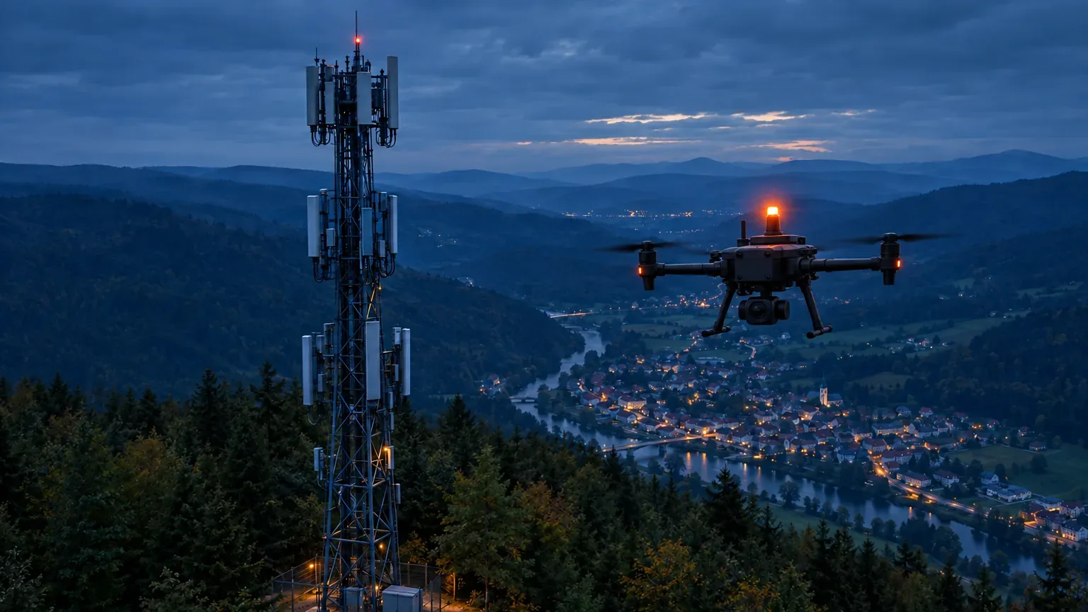
The schematic is not to scale and is not a design for a specific site. It shows where the drone is, which two networks carry the frame and where the decision is made.
Red and blue beacons: police, state, the military in training. Orange: everyone else. The blink is only on screen. Schematic, design. The list beside it explains the codes in the drawing. The beacon is a payload from another maker, not an AKIZU product.
Concrete case
The same illustrative case as above, written out in time. The times are an example. It is not a record of a flight that happened.
An illustration, not a deployment record. N
Use options
Each row is a separate use. The Parts column says which AKIZU parts it would involve. Status N is a design, C is a target, U is unknown.
| Use | Who uses it | What AKIZU supplies | Parts | Status |
|---|---|---|---|---|
| A network profile at altitude | Mobile operator | Age and cells at three altitudes | Brain, SIM, Platform | N |
| Input for an aerial SIM | Operator | Repeated routes, not one flight | Brain, Platform | N |
| A comparison with and without priority | Operator | The same segment, two modes | Brain, SIM | N |
| A check after a cell change | Network planning | Before and after on the same route | Brain, Platform | N |
| An aerial SIM profile | — | Availability still unknown | SIM | U |
None of these uses is deployed today. A row is not an offer and not an authorisation to fly.
01
At 60 to 120 m a drone sees more cells at once and behaves differently from a phone on the ground.
A drone operator needs a number for risk assessment, not an average from a speed test.
If the network offers priority on demand, you need to show what it changed in the image.
An aerial SIM profile needs several altitudes and several days, not one good-looking flight.
The same situation, different information on the screen. Proposed behaviour, to be verified in a pilot.
| Situation | Without AKIZU | With AKIZU |
|---|---|---|
| The image is late | The image looks live; the pilot does not know how old it is. | Frame age is on the screen and the state changes to Reduced freshness. N |
| One network fails | The image freezes or breaks up. | The frame arrives over the second network; the switch is logged. N |
| You need to explain what happened | Video without exposure time and without commands. | Evidence package with image age, states and commands. N |
| Your own drone, your own software | Image-age measurement has to be built from scratch. | Brain and VERA as a module with a clear interface. N |
02
The flow is illustrative. AKIZU is in development.
03
How many metres further the drone is than the image shows. Pick a scenario or set the speed and image age.
The interactive calculation requires JavaScript.
Scenario speeds are examples. 87.4 ms is the p99 measured internally over WiFi with a phone as transmitter, not on a drone.
04
| Requirement | How AKIZU answers it | Status |
|---|---|---|
| Network behaviour at altitude | Image age, signal and cells per segment and altitude | N |
| Comparison with another network | Brain Duo with two SIMs on the same route | N |
| Effect of data priority | Comparison of flights with and without priority | P |
| Aerial SIM profile | Availability with operators still being verified | U |
05
Sees image age and signal per cell at flight altitude.
Has material for an aerial SIM profile and tariff.
Can show customers numbers from real flights.
06
07
On 1 December 2025 Nokia obtained an EASA design verification report for its LTE/5G drone system, usable in SORA assessments.
Source: Unmanned Systems Technology
Deutsche Telekom and Nokia demonstrated a drone whose network priority was temporarily raised at flight altitude.
Source: Nokia
LTE and 5G. The Brain Duo concept sends every frame through two operators at once. The 3GPP standard expects the network to recognise a drone in the air, so we plan AKIZU SIM cards with an aerial profile at the operator.
The AKIZU design is built around LTE and 5G. According to the manufacturer, the Starling 2 Max base platform also supports Wi-Fi and Microhard. Our internal measurement was done over WiFi.
Brain will have a nano-SIM slot. We plan AKIZU SIM as an option managed in AKIZU Platform. Terms for using other cards will be agreed with partners.
09
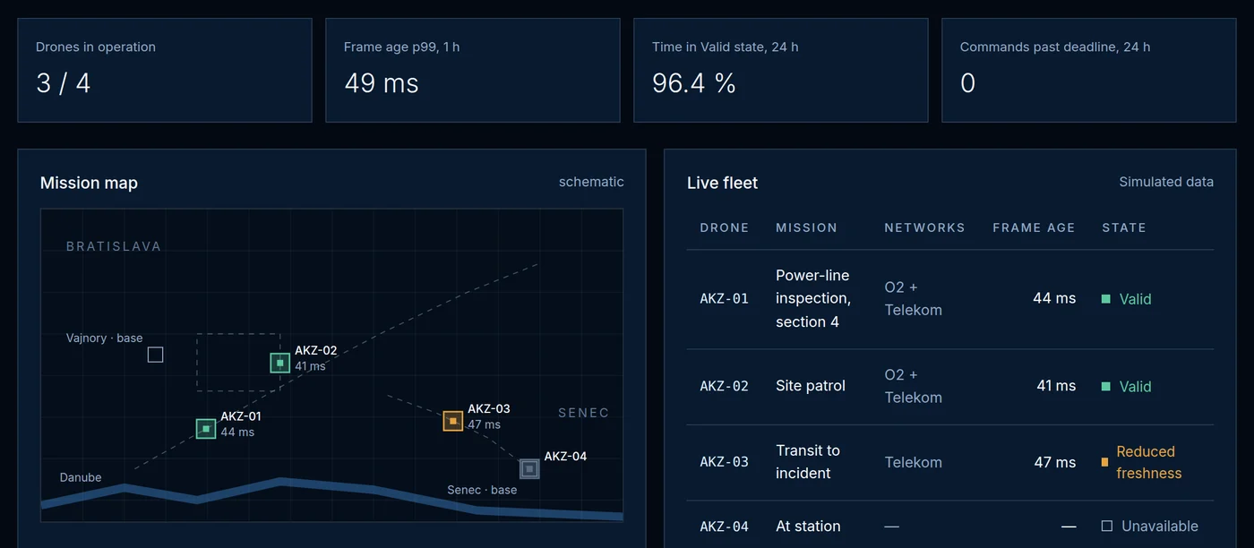
The three image states in this area. Proposed behaviour, to be verified in a pilot.
At this altitude the network carried the image within the deadline.
A segment where priority or the cell was not enough.
A segment without a usable image. It does not pass in the report as covered.
10
Illustrative layout. Drone and station counts are an example, not an offer.
Route at altitude
Your SIM and a second operator's SIM.
The same route
Comparison of day, altitude and priority.
Radio and product
Numbers from the flight, not a map for the ground.
11
Times are an example. They show when image age decides.
12
AKIZU does not sell connectivity and does not switch on priority in the network.
The report holds for the routes flown, not for the whole network.
Availability with operators is still unknown.
A pilot in this area
We are looking for first partners. The application is pre-filled for this area.
Other areas
Example deployments are illustrative. AKIZU is in development and does not replace a BVLOS authorisation.
In more detail
We want altitude, not a ground average.
A route at 30, 60 and 120 m is an example, not a standard. A repeat on another day belongs in the report.
We do not switch on priority. An aerial profile is still unknown. We are not a virtual operator.
Explore
Twelve solution areas and the sections that belong with them. The case studies are illustrations, not completed deployments.